UPDATE: We have a new satellite map with an incredible resolution of 1-2m/px globally. Read more about it here: Global high-resolution satellite map.
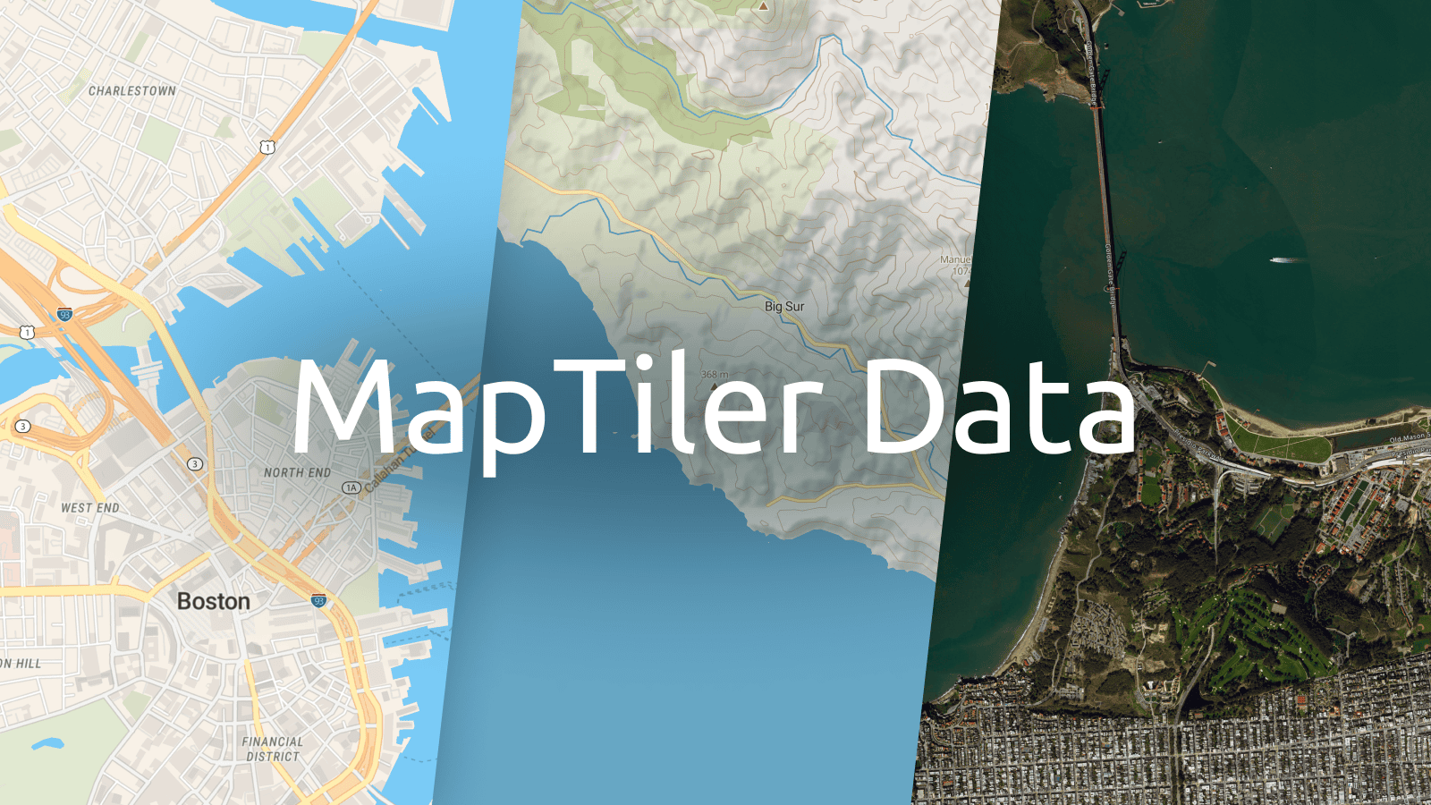
MapTiler Data has launched. It provides ready-to-use geographical data of the entire world for your web & mobile applications and the use cases you have - including on-premise applications.
Download data package with basemaps
To publish interactive maps from your own machine, all you have to do is to download data together with our beautiful map styles for your server software.
Data package includes street, satellite, and terrain data of the entire world to let you build maps for various use cases. Geodata is regularly updated to bring you a fresh view of the always-changing world.
The best map styles from MapTiler - Streets, Basic, Bright, Topo, and Satellite with labels - are now available for download. You can also create your own map style.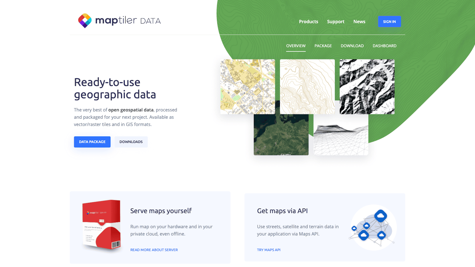 Together with the data package, we also provide a native server software for Linux, Docker, Windows, and macOS, allowing you to host the data and provide map services to your clients. All you have to do is unpack downloaded geodata and map styles into the server working directory, and it gives you immediately map endpoints and map services for your applications.
The software is also able to serve your own tiled vector and raster geodata.
Beautiful map styles
Appealing high-contrast colors, 3D buildings, easy-to-read map: all you need from modern cartography is in the Street map.
MapTiler Basic is a basemap that tries to stay in the background and only gives the most relevant information. Colors are calm, so the data you overlay can shine through.
OSM Bright is a general-purpose base map showcasing the incredible detail of the map data. It is a great compromise between an easily readable map and a basemap for an overlay.
Topo map is one of the most complex ones showing natural relief altogether with the contour lines and hillshading. It is an excellent map for moving around in nature.
Satellite Hybrid contains satellite imagery and just enough information you need to get oriented: road lines, labels, and boundaries.
New datasets in MapTiler Data
High-resolution aerial imagery of the USA and Western Europe
USA, Japan, and many Western European countries (e.g., France, the Netherlands, Denmark, to name a few) are available in extremely high resolution, which goes up to 8 cm/pixel in the most viewed areas.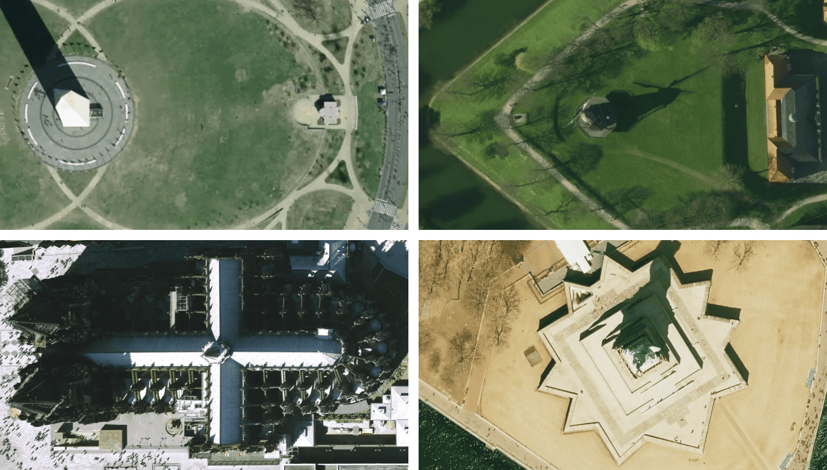 For details about coverage and resolution, visit our satellite page; for an offer, contact us.
Top-notch hillshading
The brand new RGB terrain dataset can be used for many applications. The most common one is the classical hillshading, which looks much better thanks to this dataset.
The presence of elevation data in the RGB terrain dataset allows more sophisticated usage like picking the real elevation value of a selected point on Earth or drawing a track elevation profile for a given line.
To make your maps look enormously realistic, load the RGB terrain in 3D JavaScript viewers or use it for dynamic hillshading.
Landcover for global forest coverage
Landcover data are newly available for zoom levels 0–9 and shows generalized physical coverage of different areas. This dataset perfectly fits with the landcover data from OpenStreetMap, which are available starting zoom level 10 and offers much higher accuracy. A fantastic example of landcover usage is on higher zoom levels on our Streets map.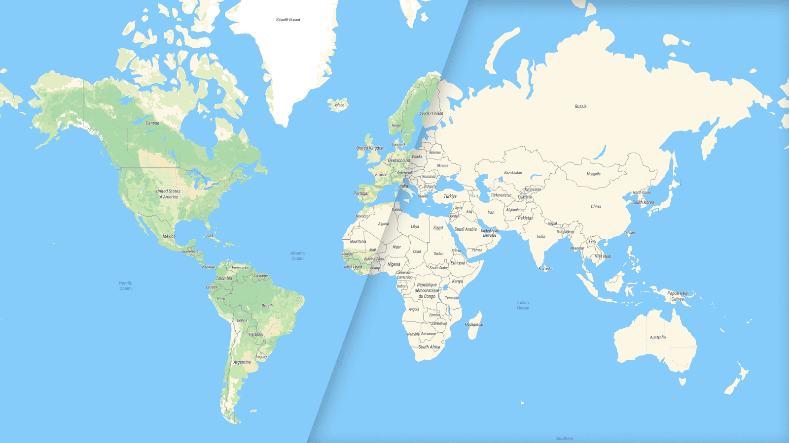 What makes the map on the left so crispy? The only difference is (missing) landcover!
Upcoming data updates
Beginning next year, a brand-new version of our street data will be released. The major change is generalization of buildings on zoom level 13, which brings a much more realistic view of the downtowns.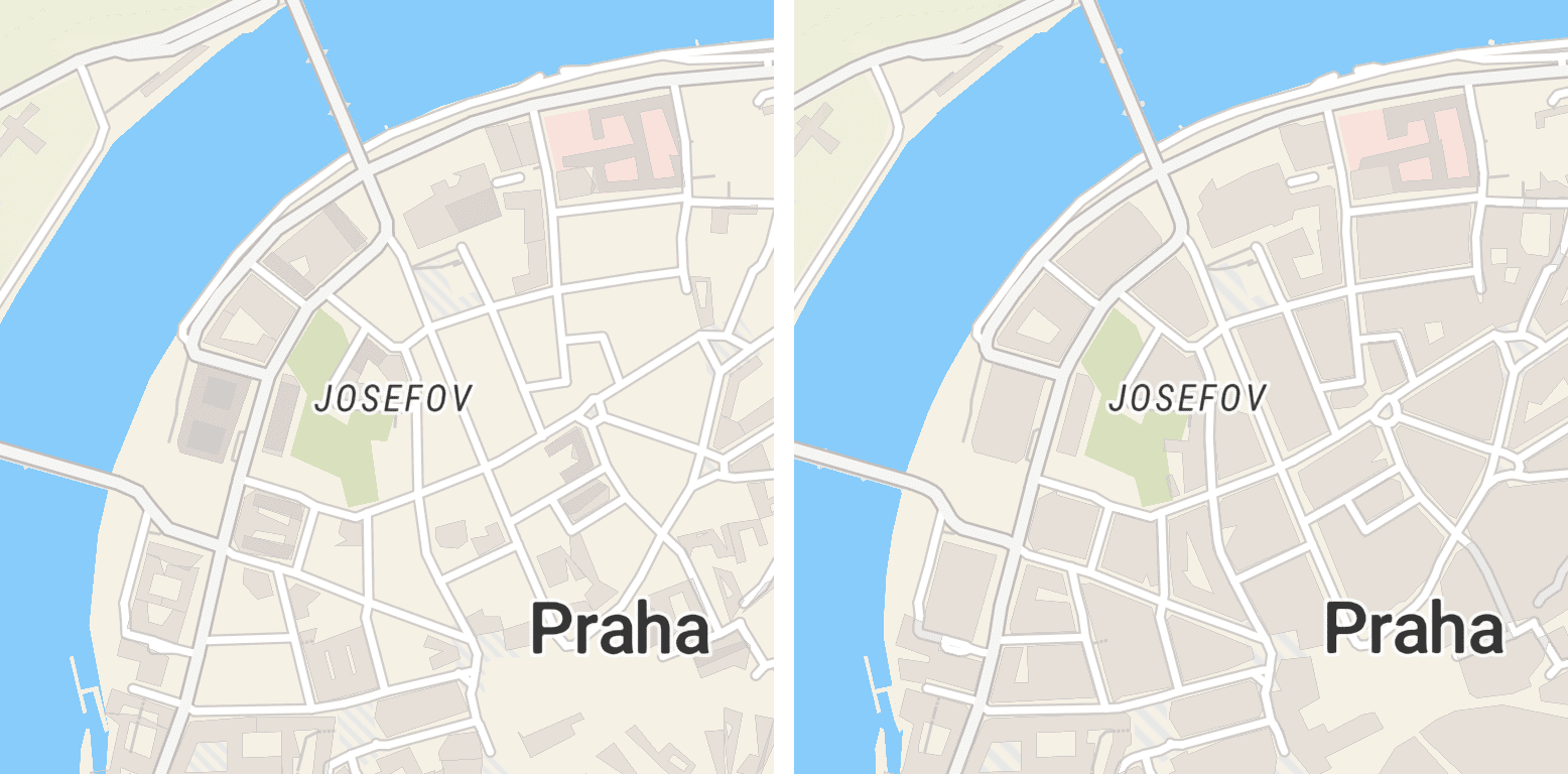 Generalized building on zoom level 13 shows accurate data in downtowns.
Currently, we are also processing a new generation of our terrain data. Derivates, namely RGB terrain, hillshade, contours, and finally Cesium terrain, will follow afterward.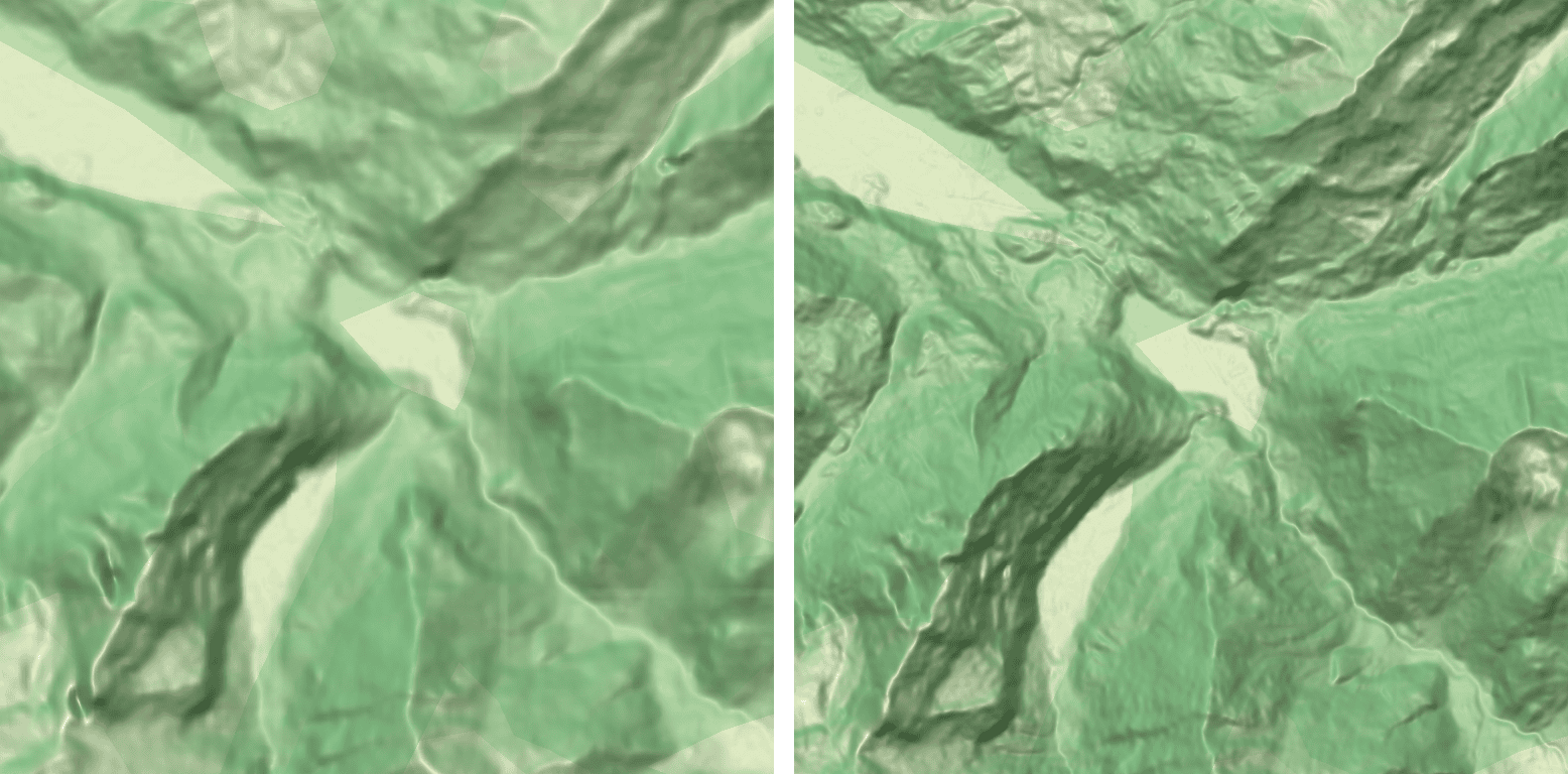 Beginning the next year, we are also planning to introduce the new cloudless mid-resolution satellite map.
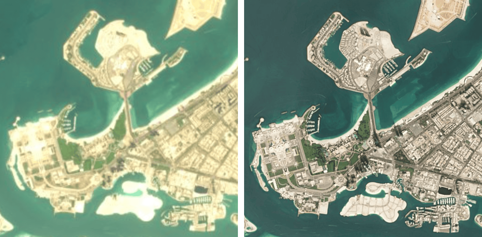 The old cloudless satellite vs. the new one
New UX for data management
The brand-new administration brings multiple views on the status of your data, subscription, and organization. My downloads tab allows you to see what you have already downloaded, what is waiting for being processed, and which datasets are ready for download.
Data package and Server tabs allow you to manage your subscription and MapTiler Server license. Under the Members tab, you can manage your organization: see who is in your organization, add/remove members, and grant/remove administrator role.
Under the Autoupdates tab (that is available under Business and Partner subscriptions), you will find a script for Linux & macOS that allows regular updates of your data. Technical specification and short how-to are included.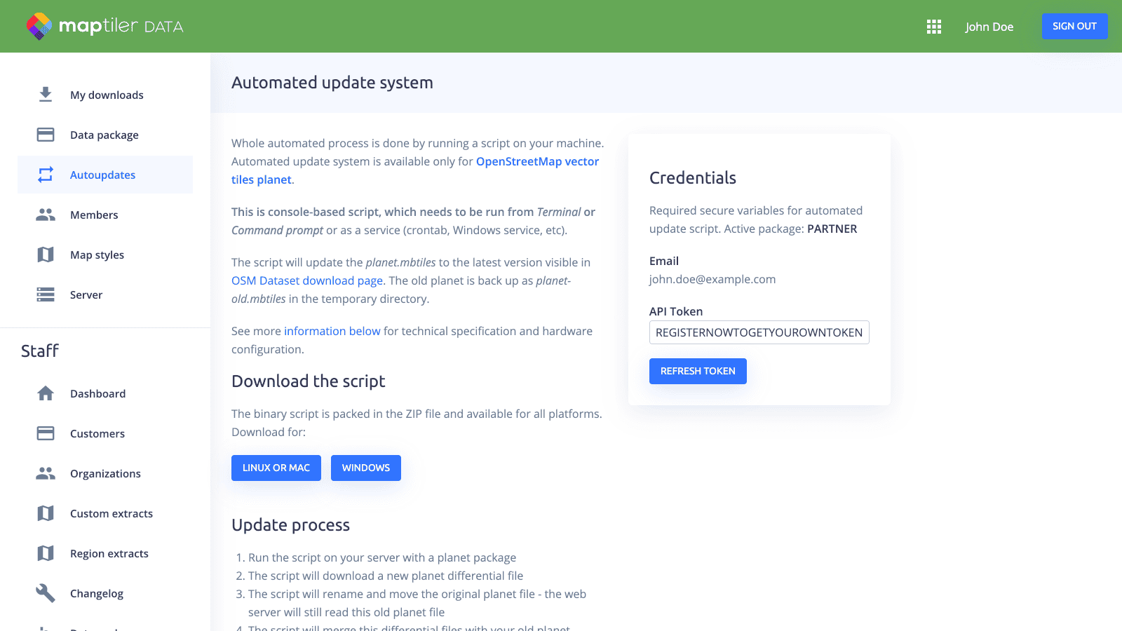 New system, new possibilities
Rewriting the backend of the website allowed us to offer improved management of downloads and additional services. This is a significant improvement compared to the predecessor: OpenMapTiles.com.