Wetter.com is the biggest weather forecast portal for Germany, Switzerland, and Austria run by ProSieben Sat1 TV group. The forecast service is having more than 20 million daily unique visitors.
Maps for weather forecast
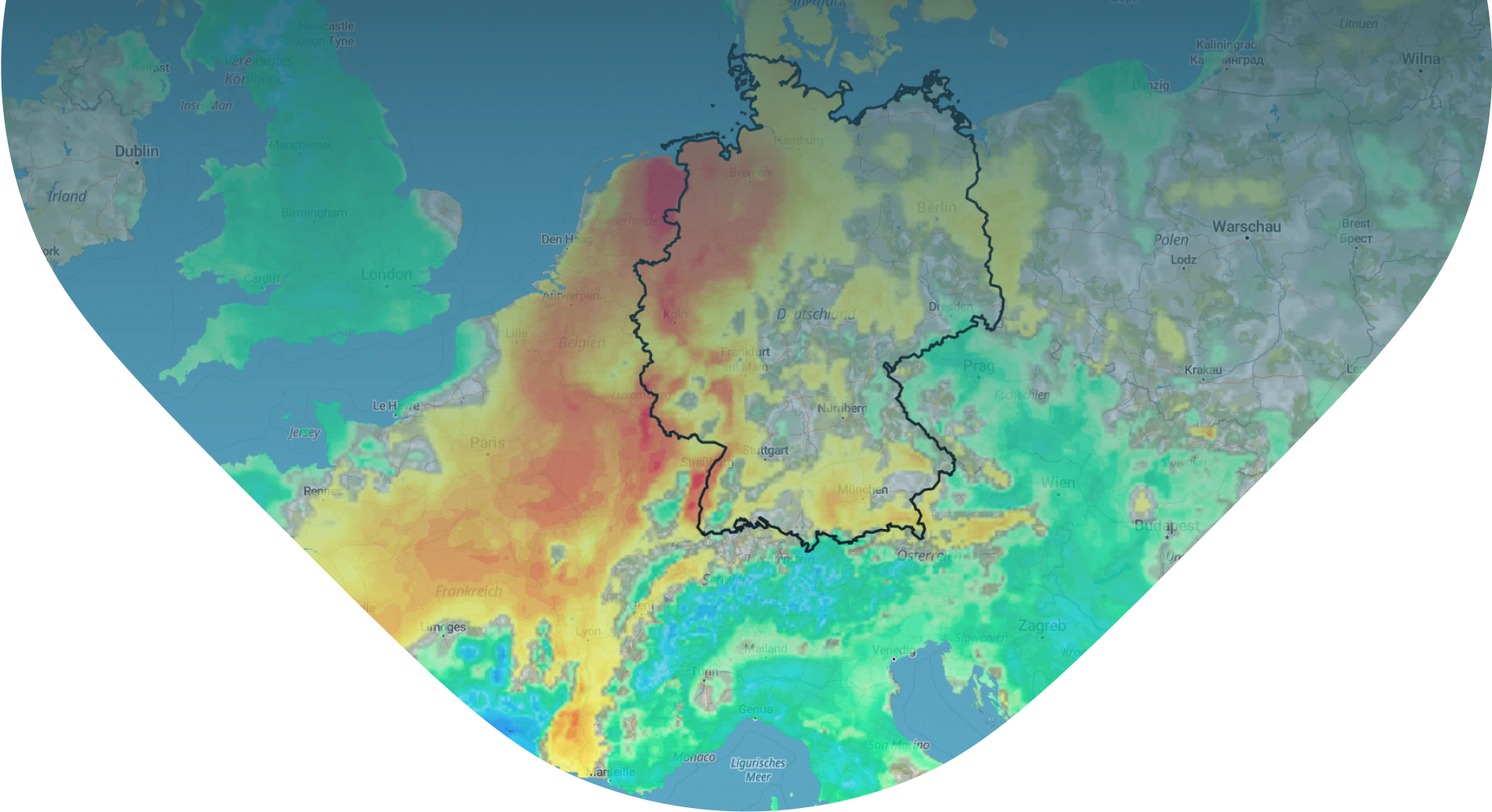
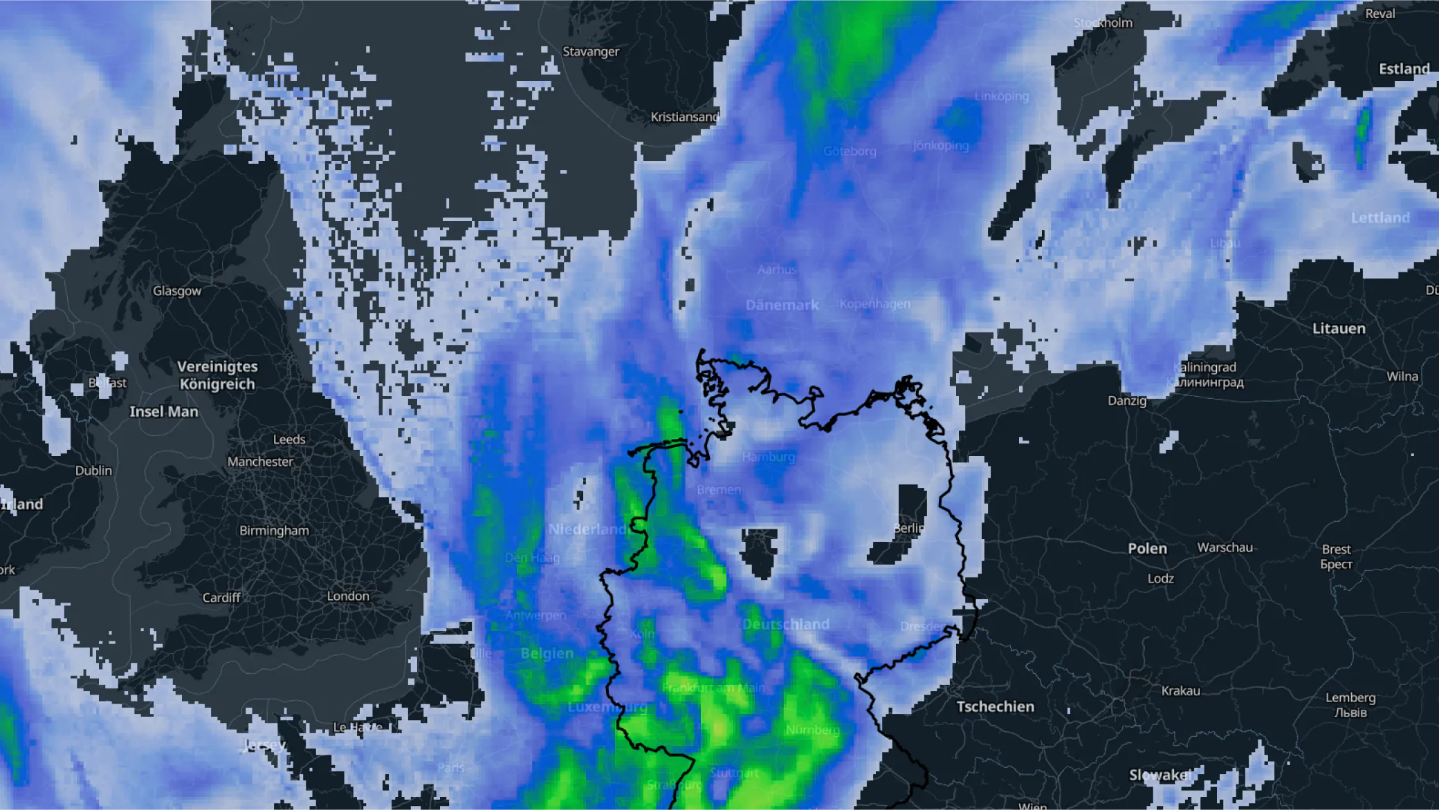
Wetter.com displays weather related information as an overlay on top of base maps provided by the MapTiler Cloud service.
MapTiler base maps can be used as a background to provide context to any spatio-temporal information, including real-time weather forecasts.
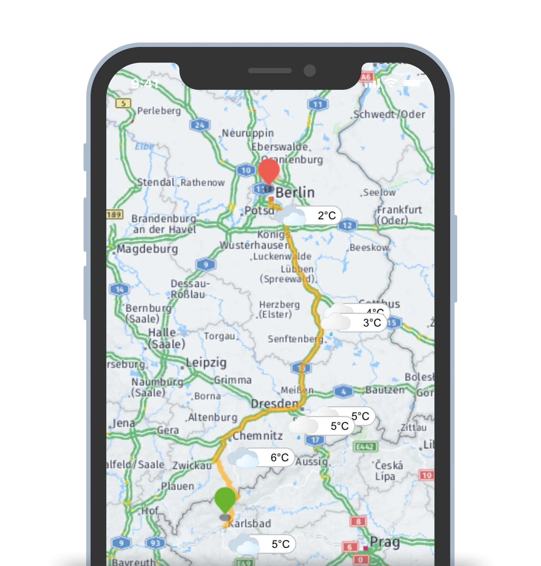
Weather on your travels, in a mobile app
Set the start and endpoint of your journey and find out about the weather along the whole way.
On top of MapTiler maps, Wetter.com will provide you with a detailed current weather, including temperatures and warnings on your route.
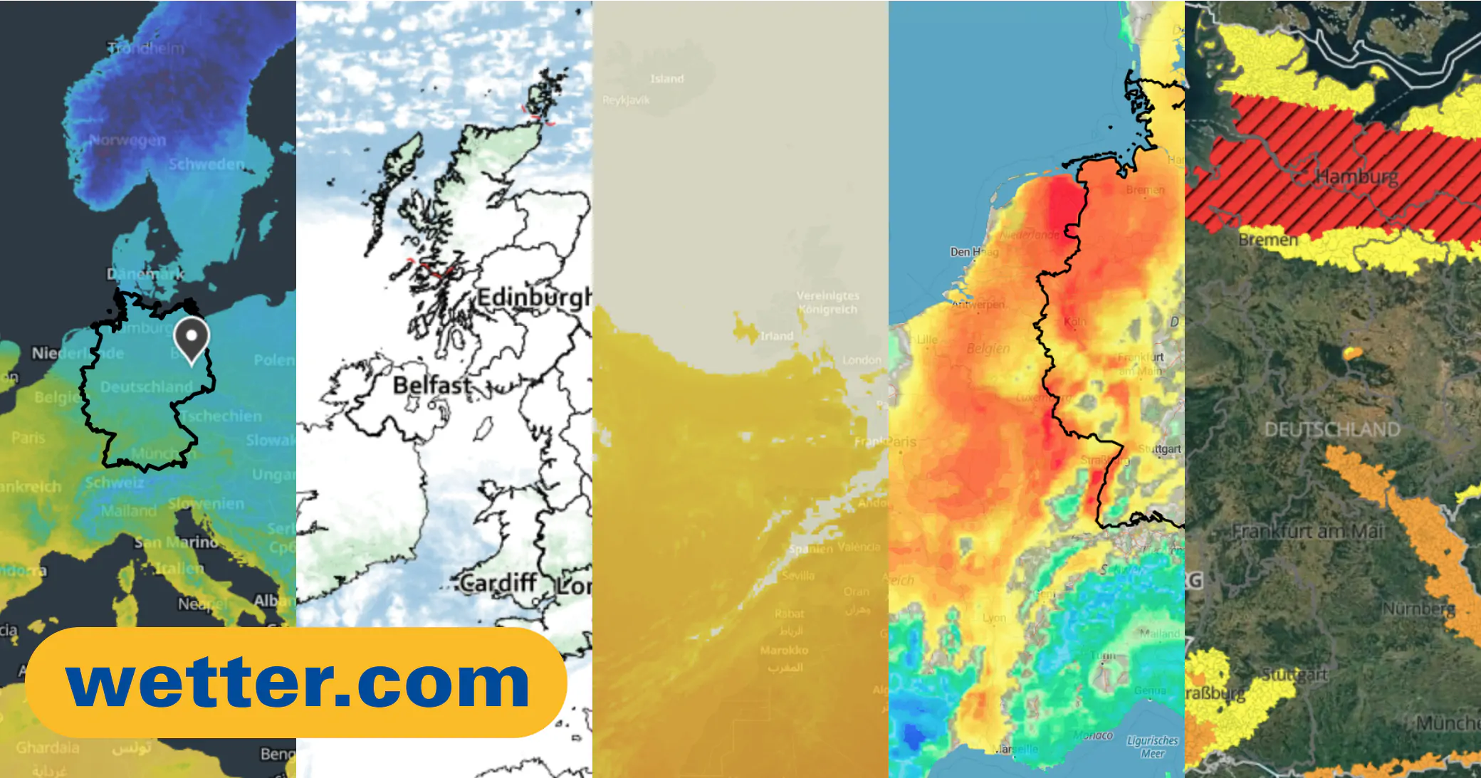
MapTiler maps used by Wetter.com
Maps for weather visualization have a wide range of use.
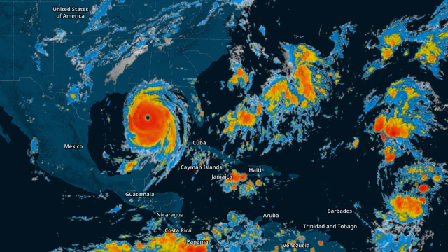
In addition to spatial forecasting, Wetter.com uses maps for communicating local weather warnings, a live precipitation radar, thematic weather maps, satellite images, HD live webcams, unique services relating to the weather, and the 24-hour channel Wetter.com TV.
All map labels, cities, and countries' names are displayed in German to fit the users' language requirements.
Visualization for your weather website
We provide full stack
-
Base maps
-
Data processing workflow (GRIB2, NetCDF)
-
JavaScript components for visualization
Try our technology