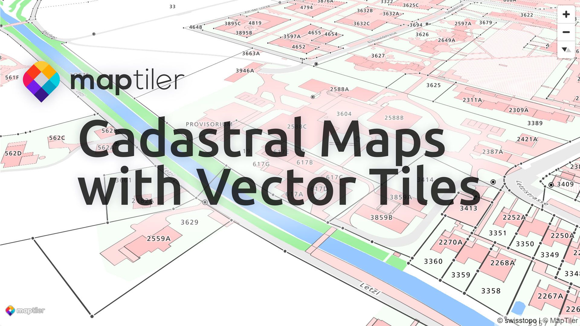
Cadastral Maps are now available from MapTiler Cloud and as data packages for self-hosting. Zoom and pan the maps to highly detailed levels, then pop-up cadastral data onto the screen, such as building names, addresses, land use, and links to official information.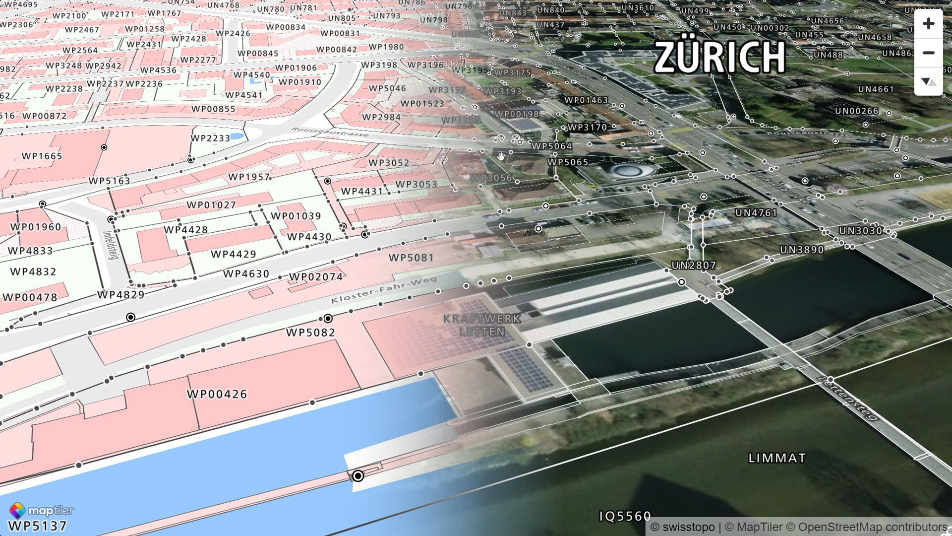 The styling is familiar for those who use Swisstopo Cadastral maps though we offer the option to switch to an aerial image backdrop.
Vector Cadastral maps
Sharp detail even when zoomed right in, our cadastral maps are built with Vector Tiles, so you can navigate without losing the detail as you would on a scanned paper map. Vector tiles are also compact and very quick to load, meaning you don’t have to wait for results.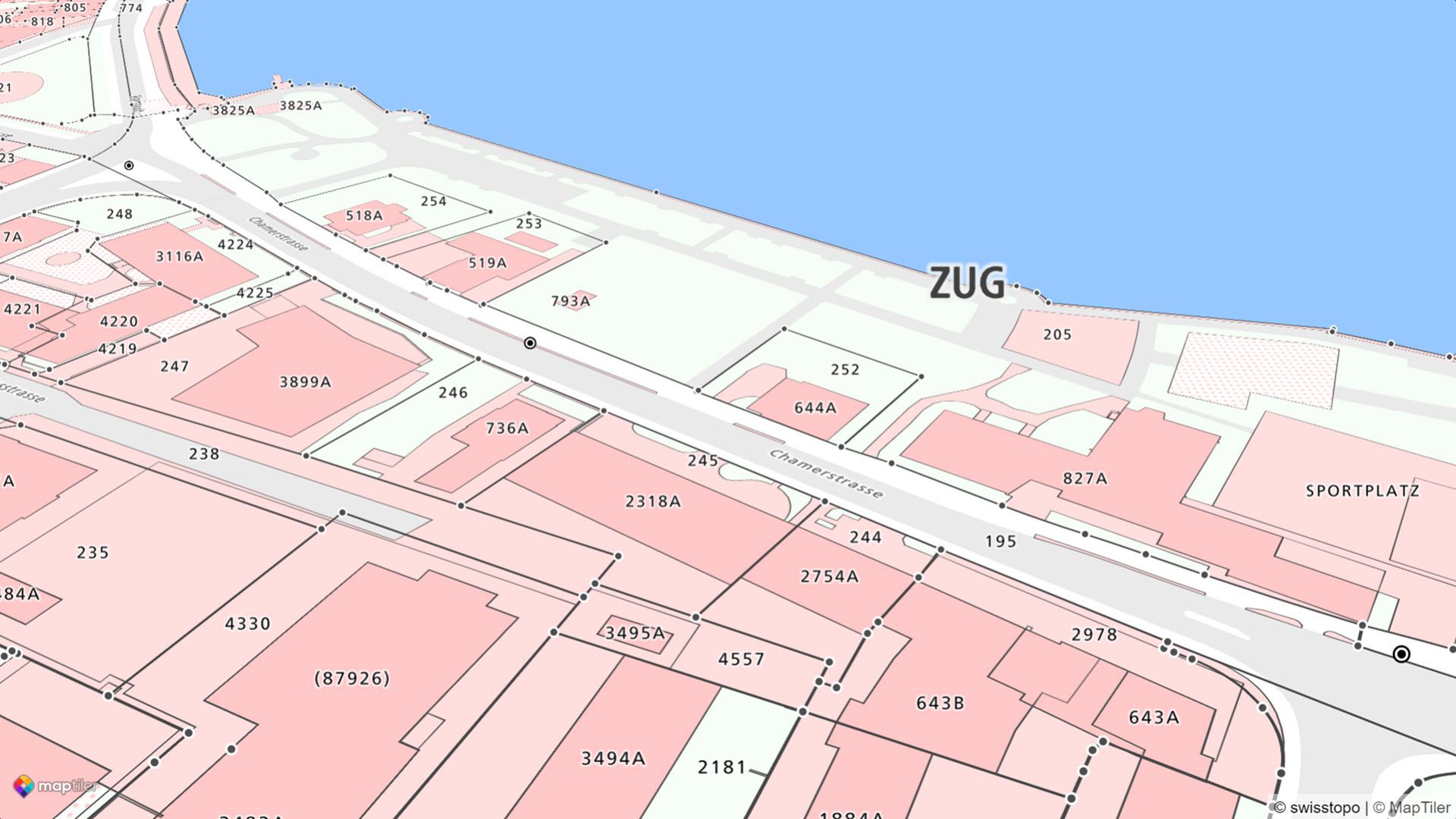 The schema for the data is intentionally minimalistic, enough to style the data, identify the land parcel, and link through to the official documentation for the legally valid details, such as ownership information and history. Keeping the detail in the official documentation means the schema will also work with data from any country as we build an international cadastral map.
The schema is detailed here: https://docs.maptiler.com/schema/cadastre/
Cadastral survey details
Pop up the cadastral data behind the map instantly by clicking on a parcel to get all the information about it.
Show Building names and addresses, land use, and codes for the official documentation on the maps as you view them. The Cadastre dataset and Cadastre map cannot be used for any legal action, so we use the parcel ID to link to the official documentation. With this link, you can access information about who owns the land or buildings currently and historically.
MapTiler Cadastre can contain data for all the Swiss Cantons; however, only some are open data and available immediately. We can make the other Cantons available to Government organizations or businesses that already hold a license; just contact us.
Self-host the cadastre
Compact vector data and MapTiler Server software allow you to build your own system for accessing and updating cadastral data. The data is portable enough to be incorporated into mobile apps and devices and MapTiler Server has PostGIS bindings allowing real-time updates to cadastral data for users in both the office and field.
Contact us for more information.
Pan-European cadastral maps
MapTiler Cadastre currently has data for Switzerland, with France coming soon. Our schema allows us to provide cross-border cadastral maps for anywhere in Europe and beyond. Please contact us with any requests for more countries or further information.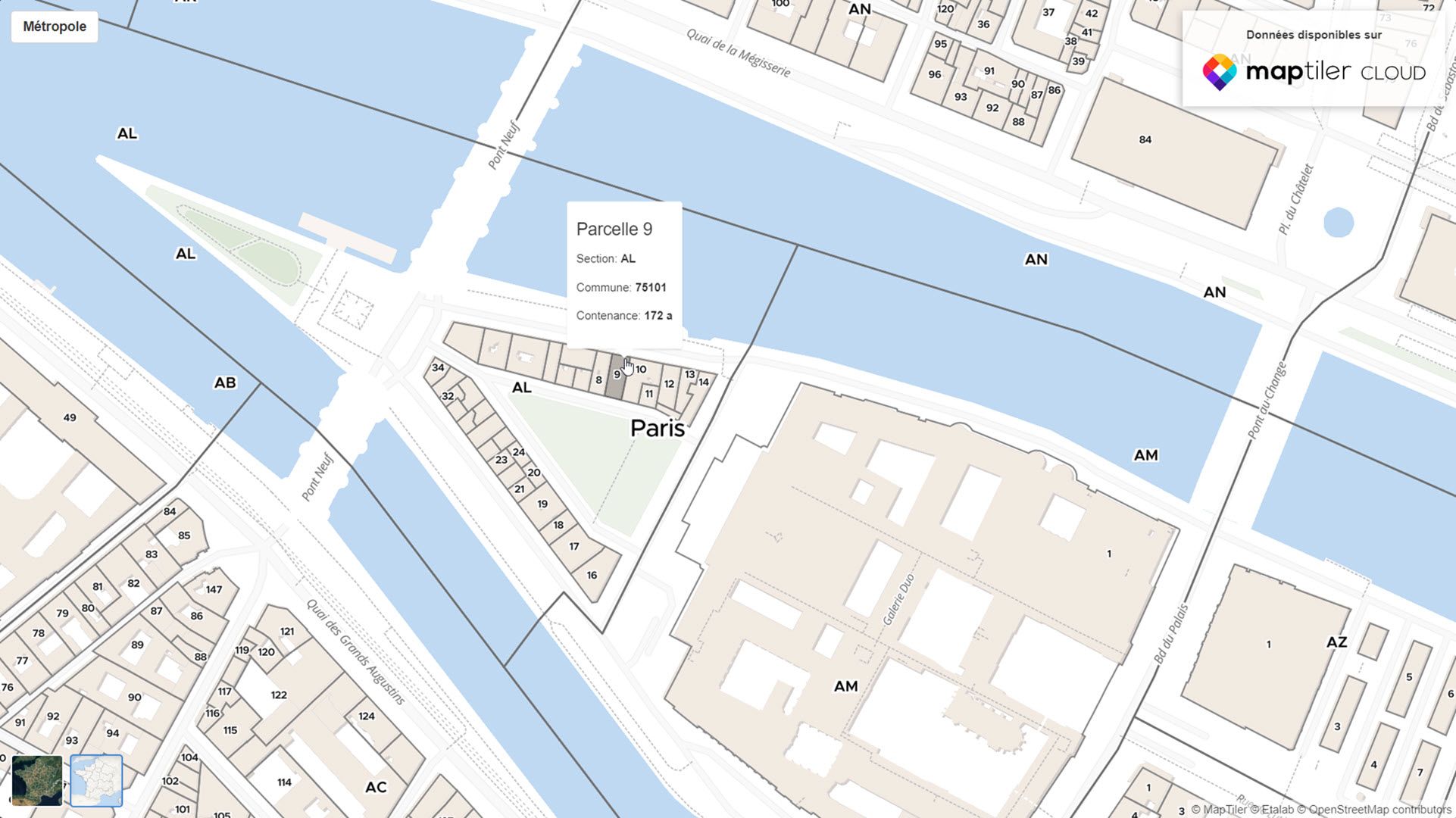
Create your own map
MapTiler Cadastre is ready to use from MapTiler Cloud, or you can customize the style to suit your purposes.
Clicking Edit Style in MapTiler Cloud lets you control how all the features appear on your map; you can have a black and white theme or one that matches your app or website’s color scheme.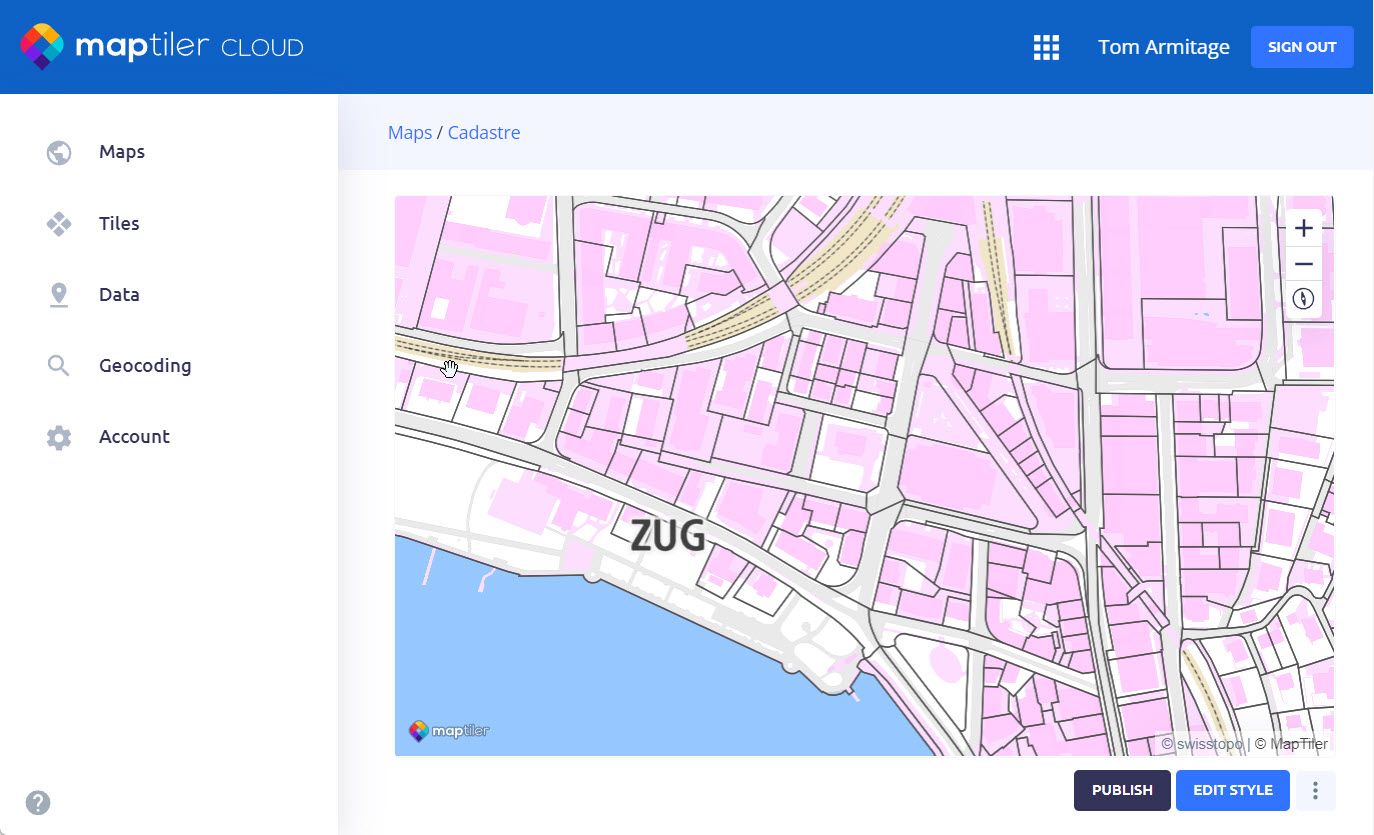
MapTiler Cadastre was developed in partnership with Luucy, a Swiss company that works in the visual urban planning space. Luucy supports early decision-making from designs with their 3D models for investors & decision-makers, from architects and government.